


ROCKLAND TWP DIST 01, Venango County, Pennsylvania
About
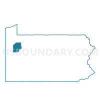
Outline

Summary
| Unique Area Identifier | 664094 |
| Name | ROCKLAND TWP DIST 01 |
| County | Venango County |
| State | Pennsylvania |
| Area (square miles) | 43.25 |
| Land Area (square miles) | 43.25 |
| Water Area (square miles) | 0.00 |
| % of Land Area | 100.00 |
| % of Water Area | 0.00 |
| Latitude of the Internal Point | 41.28090390 |
| Longtitude of the Internal Point | -79.76164980 |
Maps


Graphs
Select a template below for downloading or customizing gragh for ROCKLAND TWP DIST 01, Venango County, Pennsylvania


Neighbors
Neighoring Voting District (by Name) Neighboring Voting District on the Map
- CLINTON TWP Voting District, Venango County, PA
- CRANBERRY TWP DIST 01, Venango County, PA
- RICHLAND TWP Voting District, Venango County, PA
- ROCKLAND TWP DIST 02, Venango County, PA
- SANDYCREEK TWP Voting District, Venango County, PA
- SCRUBGRASS TWP Voting District, Venango County, PA
- VICTORY TWP Voting District, Venango County, PA
Top 10 Neighboring County Subdivision (by Population) Neighboring County Subdivision on the Map
- Cranberry township, Venango County, PA (6,685)
- Sandycreek township, Venango County, PA (2,260)
- Rockland township, Venango County, PA (1,456)
- Clinton township, Venango County, PA (854)
- Richland township, Venango County, PA (777)
- Scrubgrass township, Venango County, PA (751)
- Victory township, Venango County, PA (410)
Top 10 Neighboring Place (by Population) Neighboring Place on the Map
Top 10 Neighboring Unified School District (by Population) Neighboring Unified School District on the Map
- Franklin Area School District, PA (16,283)
- Cranberry Area School District, PA (9,495)
- Allegheny-Clarion Valley School District, PA (5,755)
Top 10 Neighboring State Legislative District Lower Chamber (by Population) Neighboring State Legislative District Lower Chamber on the Map
Top 10 Neighboring State Legislative District Upper Chamber (by Population) Neighboring State Legislative District Upper Chamber on the Map
Top 10 Neighboring 111th Congressional District (by Population) Neighboring 111th Congressional District on the Map
Top 10 Neighboring Census Tract (by Population) Neighboring Census Tract on the Map
- Census Tract 2002, Venango County, PA (5,830)
- Census Tract 2014, Venango County, PA (3,908)
- Census Tract 2013, Venango County, PA (3,679)
- Census Tract 2015, Venango County, PA (3,601)